
- Home
-
About Us
About Us
No Job Is Too Big or Too Small
-
Our services
Our services
Delivering Superior Performance and Operational Efficacy
-
Methods
Methods
Offering Tailored Solutions For Customer Requirements
Seismic Methods Electrical Methods EM Methods Magnetic Methods GPR Method Gravity Methods Borehole Logging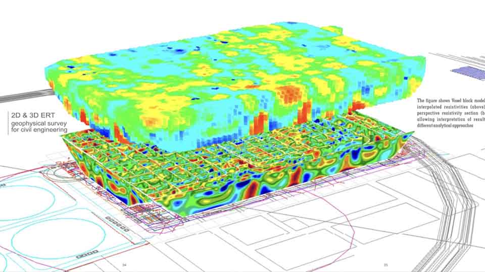
-
Project Cases
-
News
- Contact
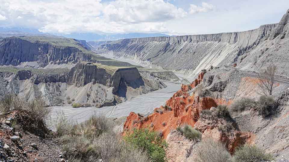
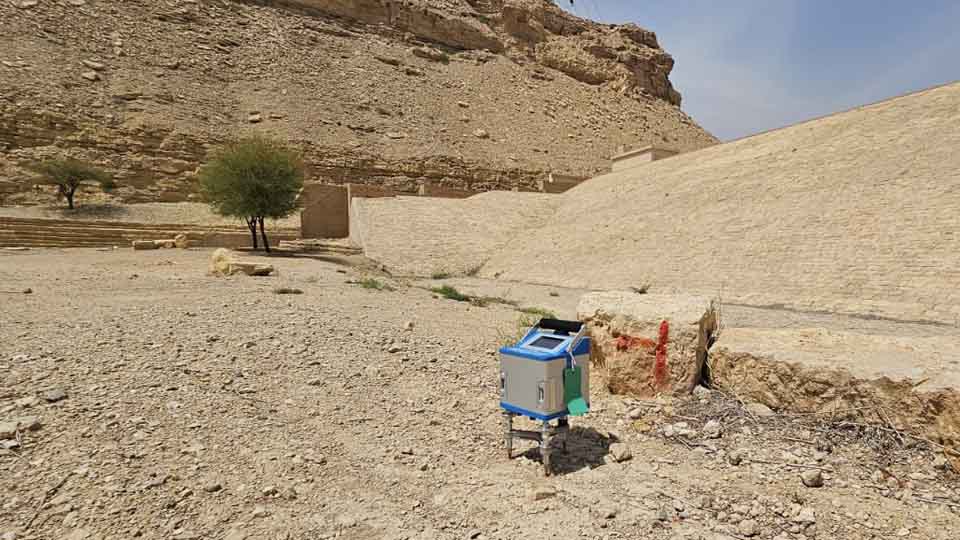
Underground manmade features whether they are recent or ancient hold a vital importance in terms of risk mitigation for future construction and saving and recording artifacts and architecture for the archeological purpose. Unexploded ordinance (UXO) and the explosive remnant of war (ERW) also present a key challenge for the safety and development of areas, which went through wars. High-resolution geophysical surveys are frequently deployed to overcome challenges presented by such sites.
Not only GCGC focused on providing high-quality locating services that meet legal and regulatory requirements, but we are also dedicated to damage prevention to protect your underground facilities.
Our Servces includes:
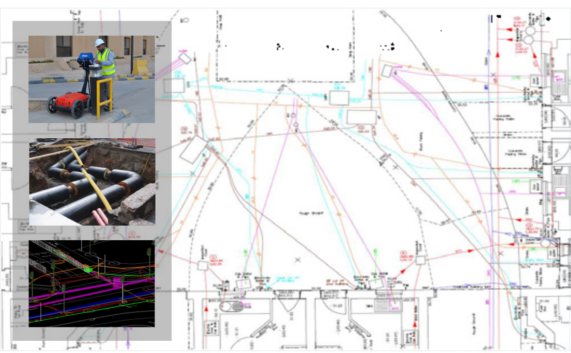
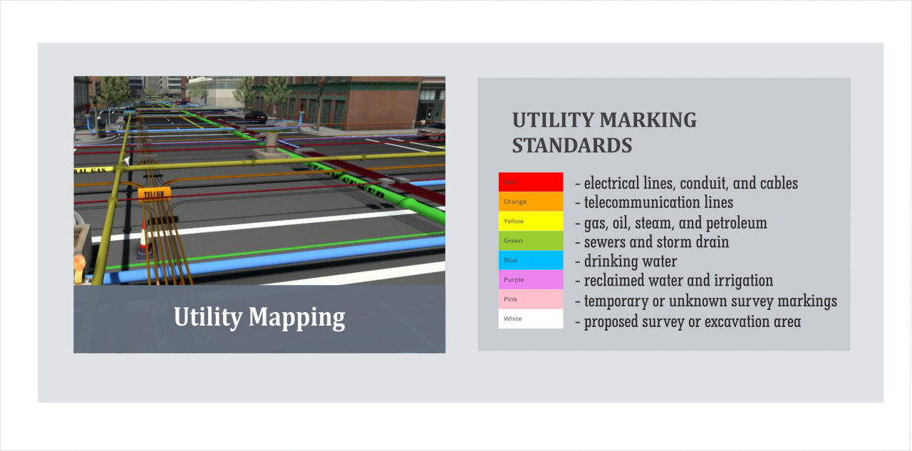
1. Utility Mapping
A utility map shows the positioning and identification of buried pipes and cables beneath the ground. The procedure involves detecting things like sewers, electric cables, telecoms cables, gas and water mains. Combine this mapping process with a topographical survey and the results will provide you with a comprehensive detailed map of anything that is hidden underground or directly related to any above ground features.
Our Core Services in Utility Mapping are not only limited to 2D Mapping of Utilities, We are also capable of generating 3D Models , GIS Models & Building Index Model (BIM)
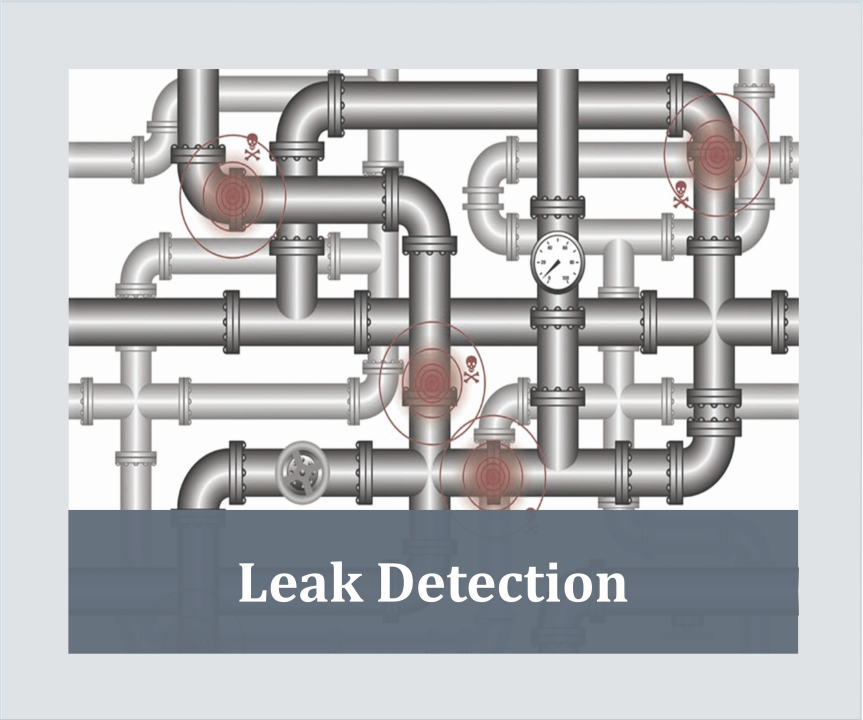
2. Leakage Detection
We are capable of doing:
-Helium Leak Detector
-Nitrogen Leak Detection
-Thermal Cameras
-Acoustic Microphones
-Infrared Radiometric
3. Concrete Scanning
Concrete Scanning helps identify safer areas for the drilling to be done on the structural surface. Following are some of the examples of concrete scanning applications:
-Concrete Assessment And Deterioration
-Structural Investigation
-Electrical Wiring in Structures
-Services & Voids in Structures
-Detection of Reinforcing Steel
Related recommendations
-
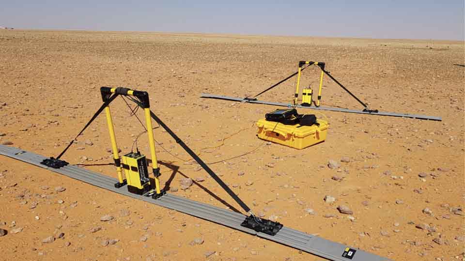
Seismic Methods
Seismic geophysical methods can cost-effectively image the subsurface over a large area and have been extensively used in deep earth studies and natural resource exploration
Learn more -
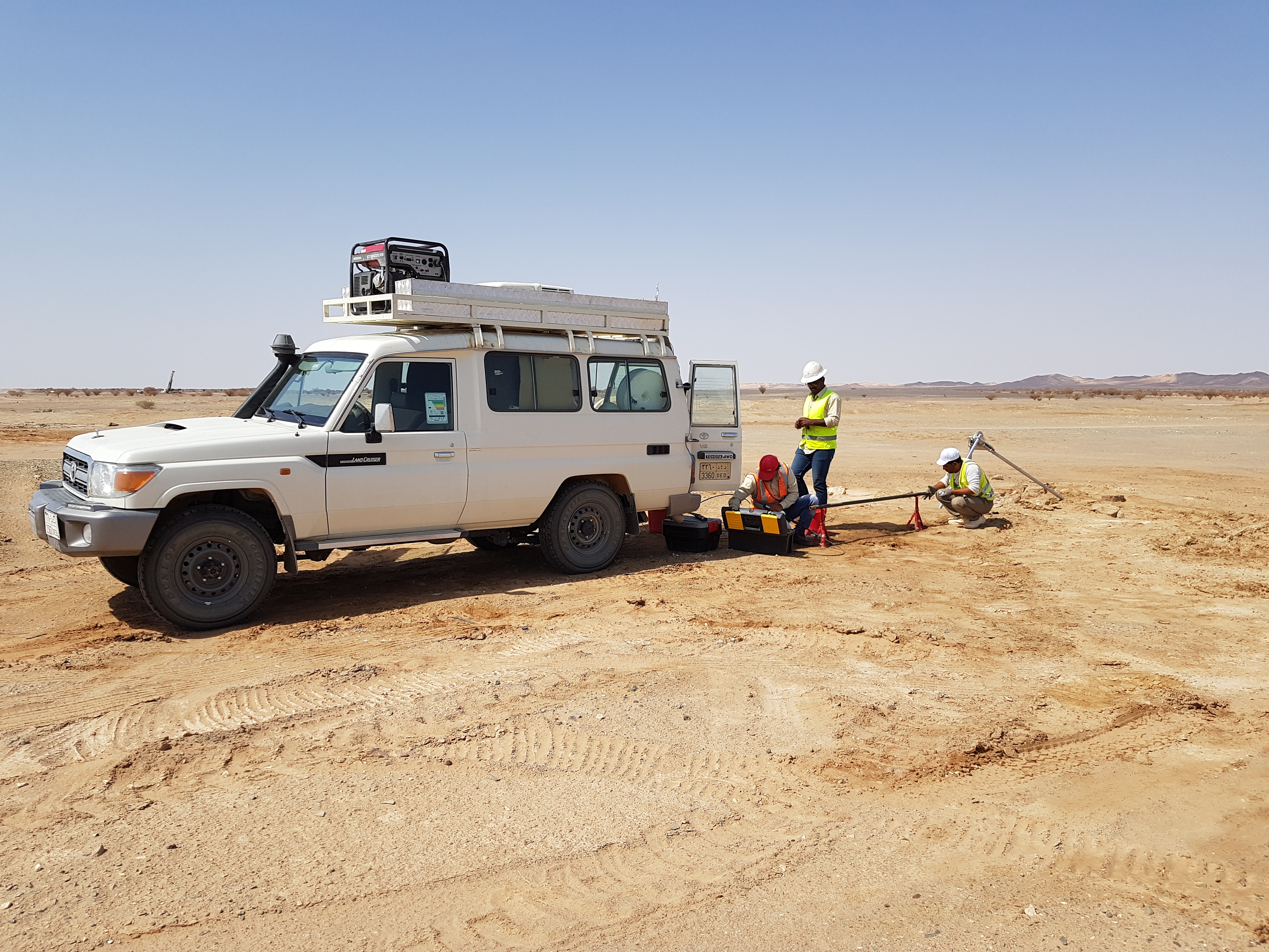
Electrical Methods
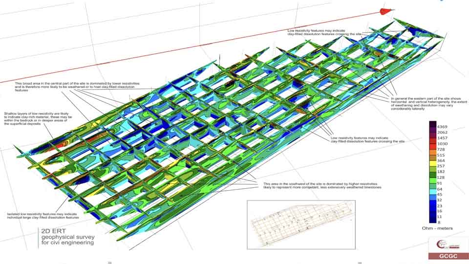
The electrical properties of the subsurface vary with the ground material, the presence and saturation level of fluids, and the presence of buried objects. Electrical techniques seek to describe the distribution of these properties as a function of depth and horizontal distance.
Learn more -
EM Methods
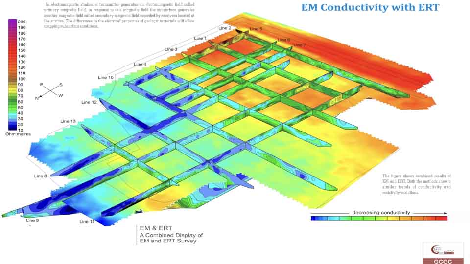
Electromagnetic (EM) surveying, the electrical conductivity of the ground is measured as a function of depth and horizontal distance. Different rocks exhibit different values of electrical conductivity. The electromagnetic method is based on the induction of electric currents in the ground by the magnetic component of electromagnetic waves generated at the surface
Learn more