- Home
-
About Us
About Us
No Job Is Too Big or Too Small
-
Our services
Our services
Delivering Superior Performance and Operational Efficacy

-
Methods
Methods
Offering Tailored Solutions For Customer Requirements
Seismic Methods Electrical Methods EM Methods Magnetic Methods GPR Method Gravity Methods Borehole Logging

-
Project Cases
-
News
- Contact
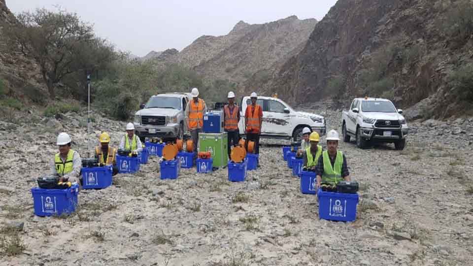

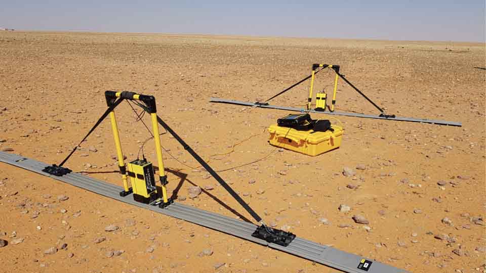
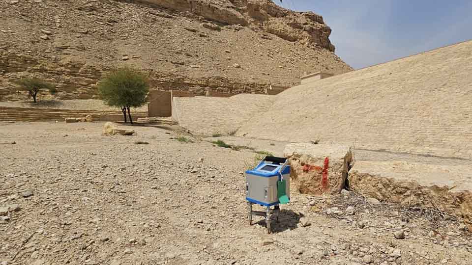
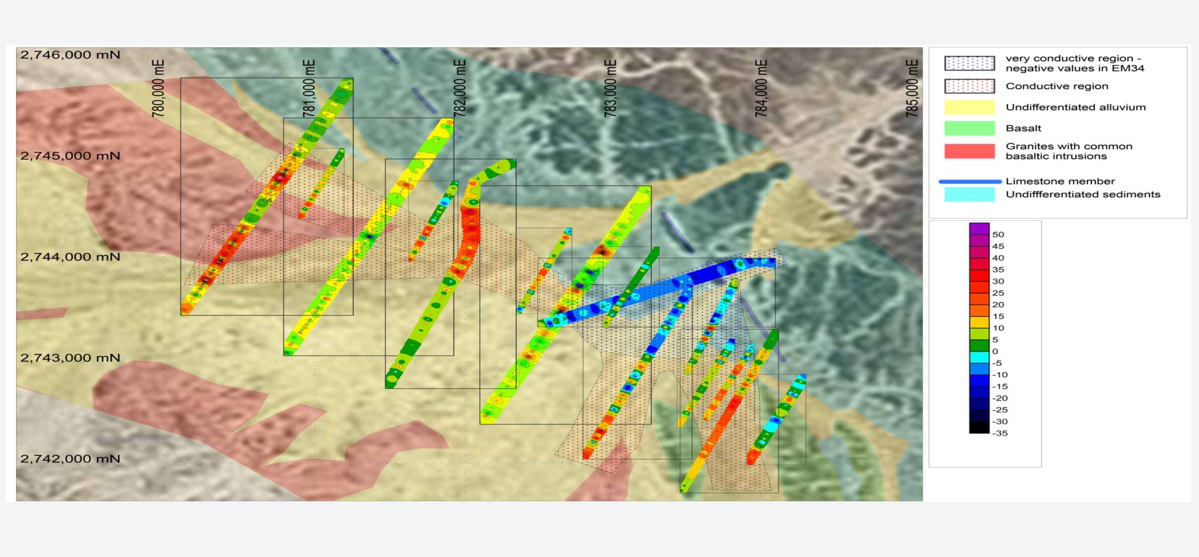
EM Methods
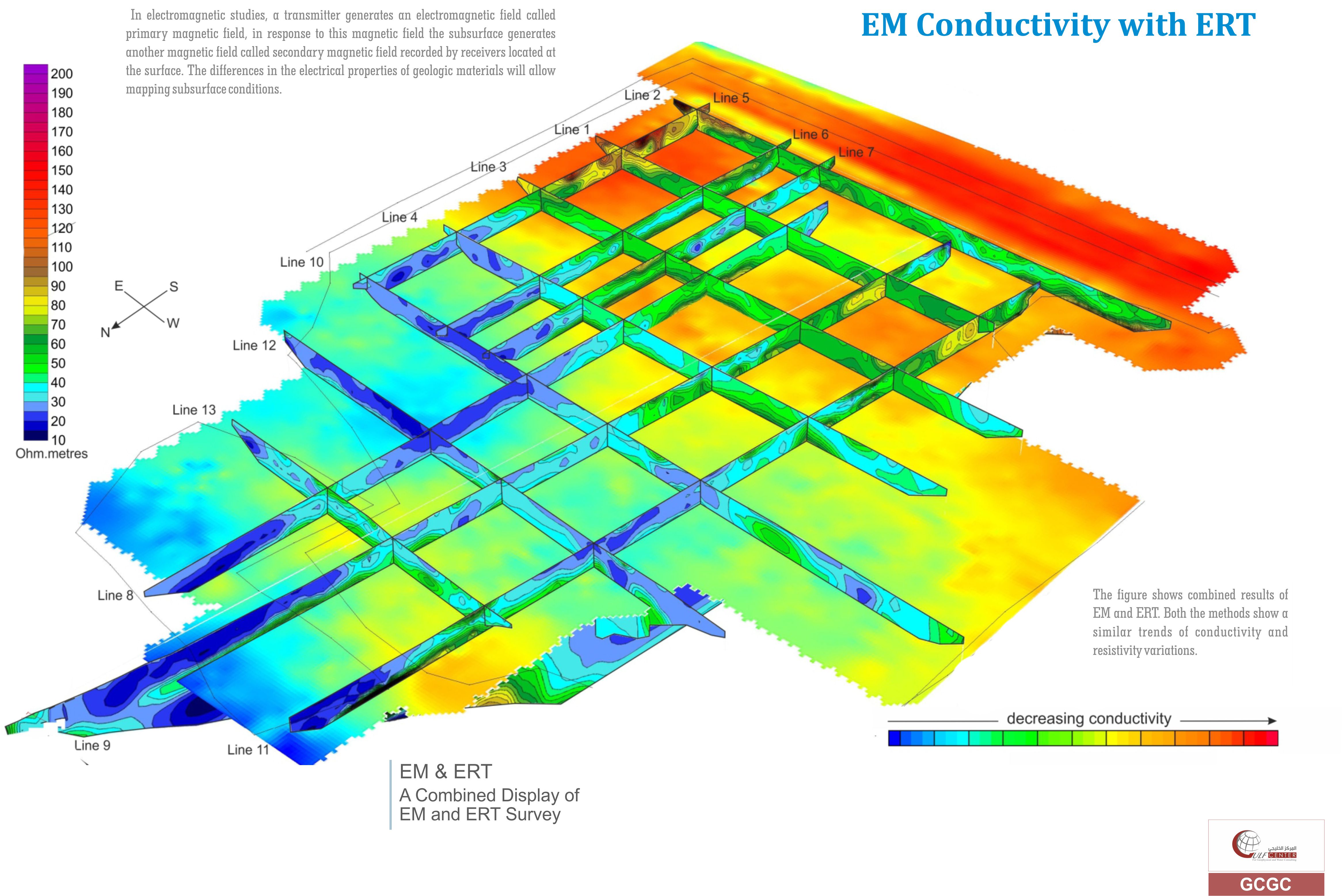
In electromagnetic (EM) surveying, the electrical conductivity of the ground is measured as a function of depth and horizontal distance. Different rocks exhibit different values of electrical conductivity. The electromagnetic method is based on the induction of electric currents in the ground by the magnetic component of electromagnetic waves generated at the surface.
1- Time Domain Electromagnetic (TDEM)
2- Frequency Domain Electromagnetic
3- Magnetotellurics (MT & AMT)
4- Very Low Frequency Electromagnetic (VLF)
Applications
- Geological and hydrogeological studies
- Cavities, voids, weathering and solution feature mapping.
- Bedrock and stratigraphy mapping
- Ground water and mineral exploration
- Contaminant plumes
- Utility detection and mapping
- Buried structures
Techniques
-
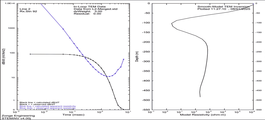
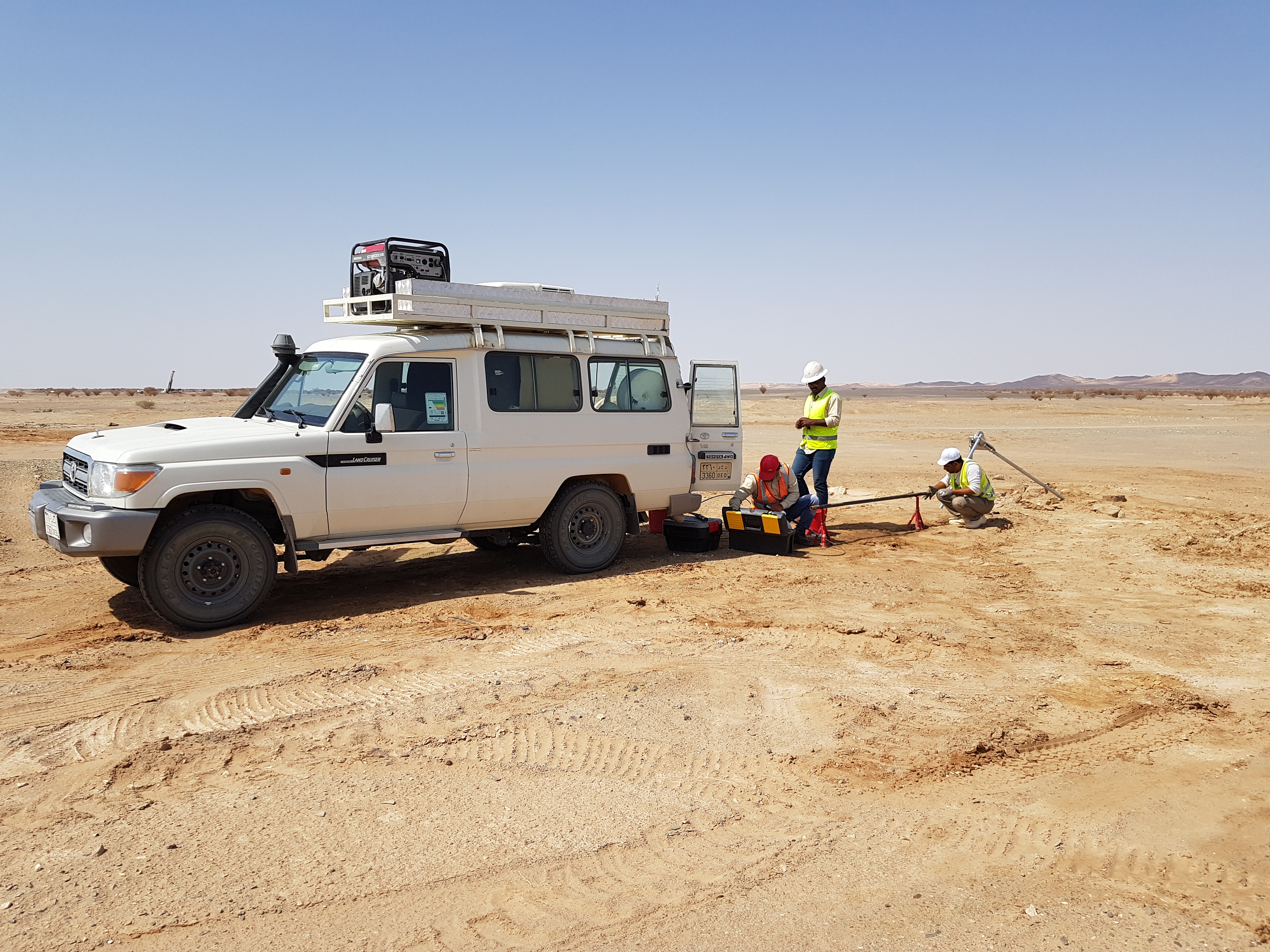
Time Domain Electromagnetic (TDEM)
TDEM involves inducing electric and magnetic fields by transient pulses of electric current and measuring the subsequent decay response. The method uses coils on the ground for the transmission of the primary electrical field and the reception of the secondary magnetic field. The investigation depth depends on the transmitting coil dimension on the ground, the intensity of the current and the conductivity of the layers. -
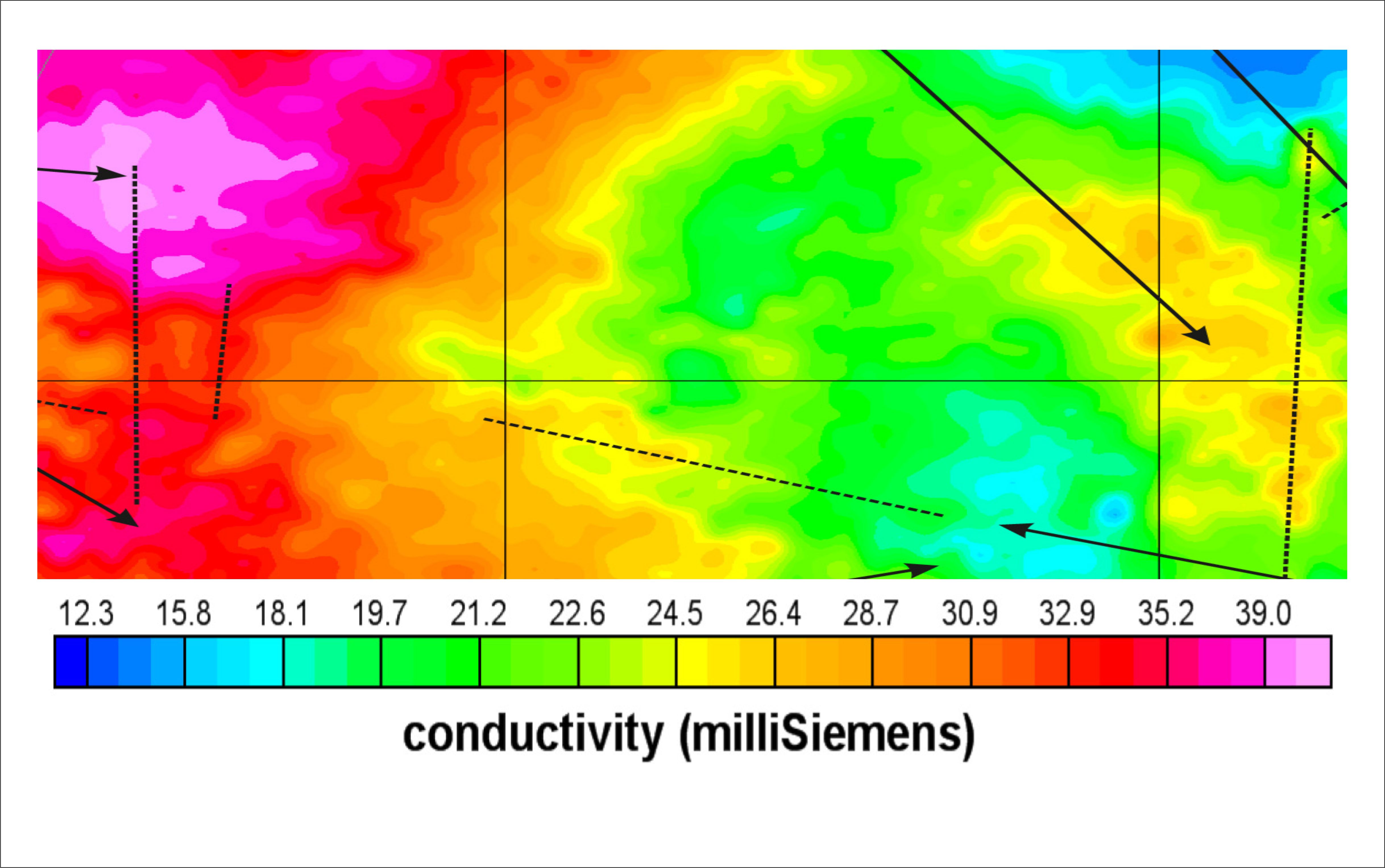
Frequency Domain Electromagnetic (FDEM)
Frequency Domain Electro Magnetic (FDEM) induction involves generating electromagnetic fields which induce currents in the earth which in turn cause the subsurface to create secondary magnetic fields. By measuring the magnetic fields, subsurface properties and features can be deduced. This method measures the magnitude and the phase of the induced currents, which are related to the subsurface electrical conductivity -
Magnetotellurics (Mt & AMT)
Magnetotellurics (MT) and Audio-frequency MT (AMT) are electro-magnetic survey and imaging techniques that use naturally-occurring ionospheric current sheets and lightning storms — passive energy sources — to map geologic structures to depths of 500 meters or more. The MT geophysical survey method combines measurements of the earth’s electric field and magnetic field over a wide band of frequencies -
Very Low Frequency Electromagnetic (VLF)
Very-Low-Frequency (VLF) surveying is a continuous-wave (frequency domain) electromagnetic technique that uses low-frequency transmissions as the source. VLF surveys involve measuring the orientation of this field. The method is primarily used in mineral exploration work but has also been successfully applied in engineering and groundwater surveys to detect conductive fault zones and other sub-vertical conductors.